Balerion Pro

Balerion Pro

professional safe and long flight time drone

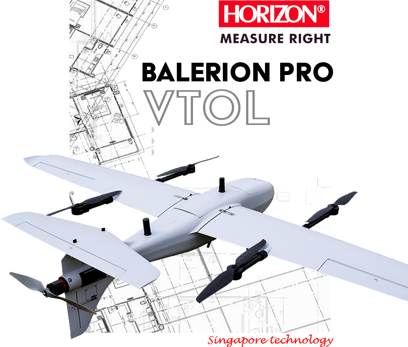
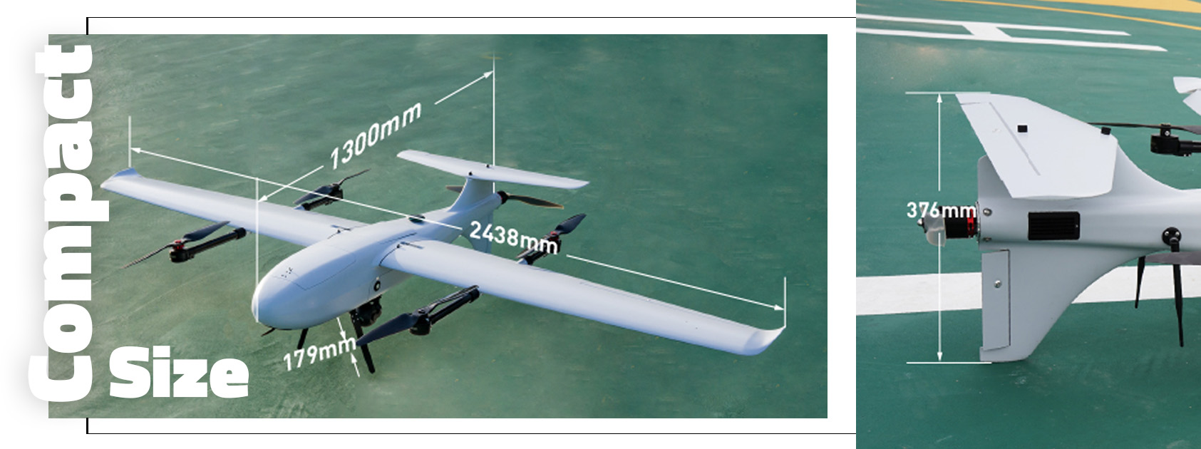
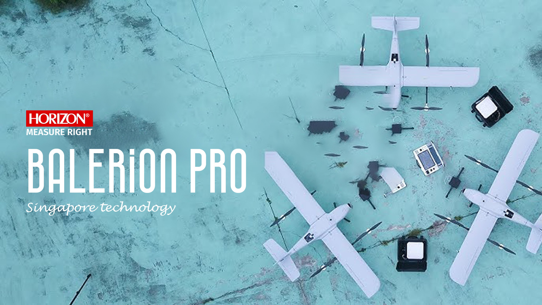
BALERION Pro is a high-endurance VTOL drone equipped with top-of-the-line hardware to ensure safe and accurate flight. Despite its compact size, the new aerodynamic design allows it to fly for up to 4 hours, covering a large area during each flight.

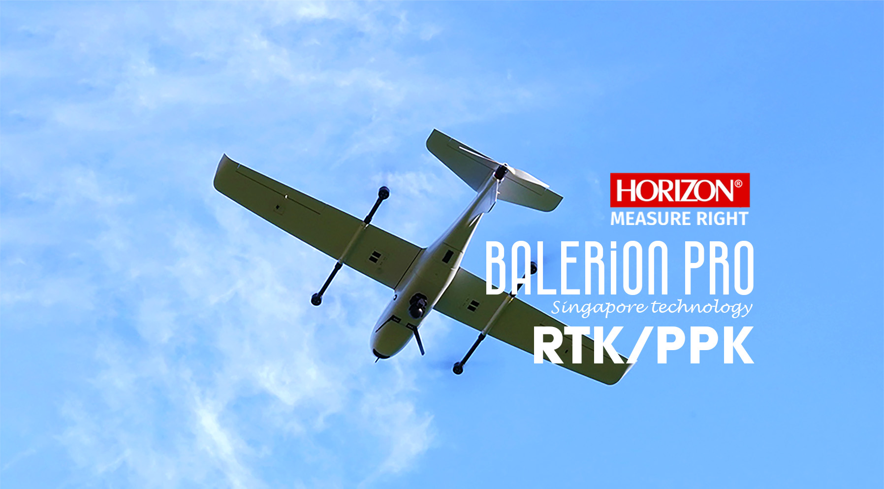
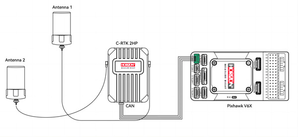
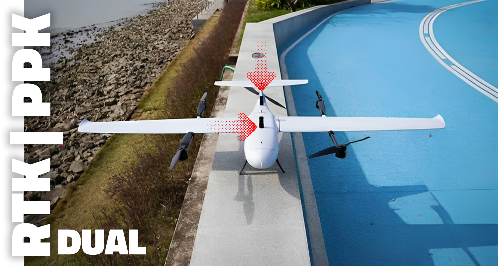
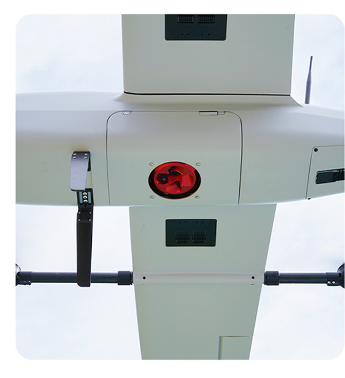
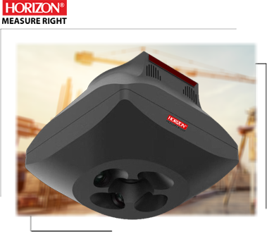
BALERION Pro is equipped with an accurate RTK/PPK module to achieve the best accuracy and reduce the need for Ground Control Points (GCPs). By using a dual antenna system instead of an electromagnetic compass, it can fly in even the most challenging conditions. Additionally, this drone features a modular design, making it easy to install or change the payload.

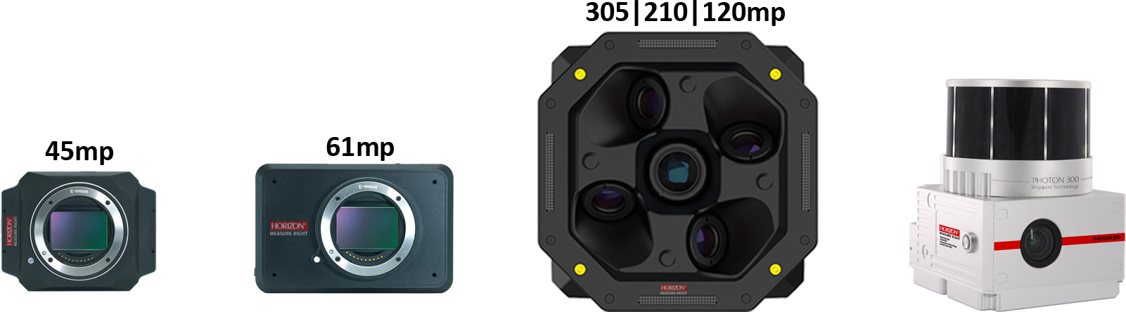
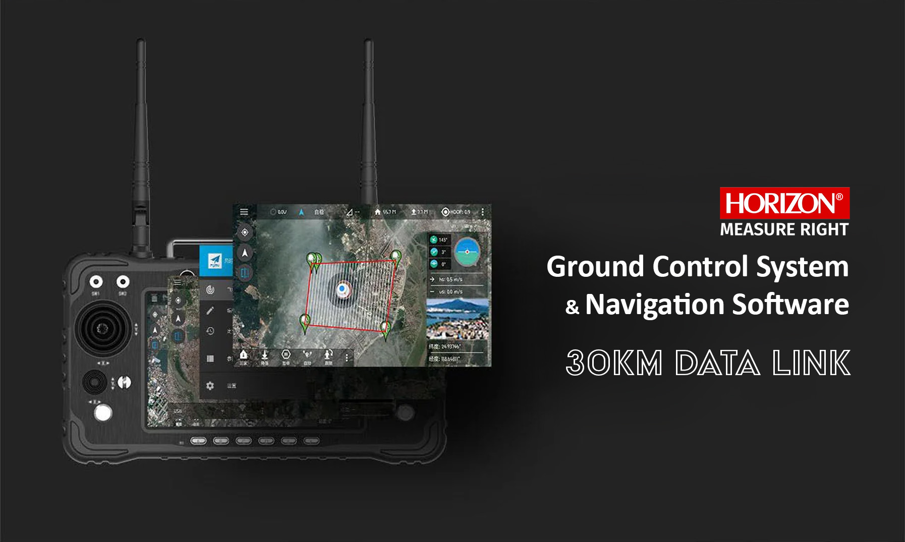
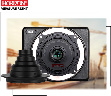
BALERION comes equipped with a Variety of payload such as LiDAR, Oblique camera and a Single camera, it means you can choose your payload according to your project. With the advanced ground control station, you can control your drone from a distance of up to 30 kilometers.
BALERION is a safe and user-friendly choice suitable for both beginners and professional surveyors.


Key features:

  • long Flight time up to 4hours
  • fly according the terrain
  • Support RTK/PPK and Network RTK Module
  • Advanced 2 axis Gimbal
  • Default Radio communications and data link stating 30km to 150km
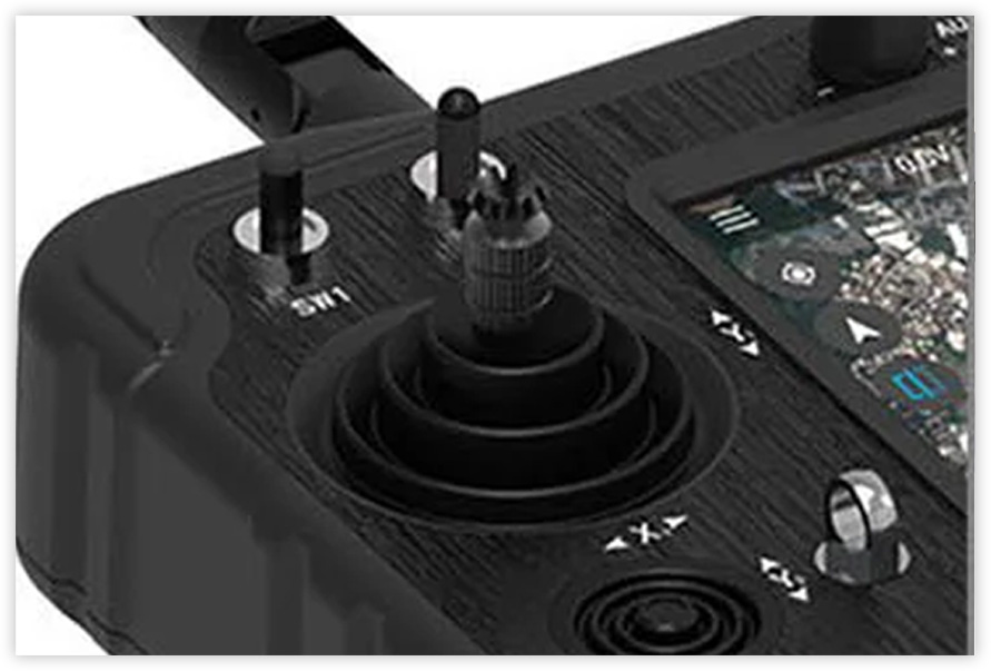
  • Intelligent 10” ground control system
  • VTOL FIxed wing with Folding Structure
  • Wingspan 243cm, compact and portable
  • Easy Swappable payload Mapping and Inspection camera
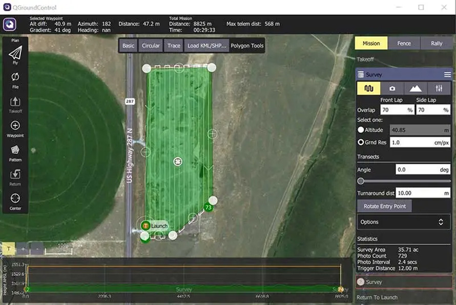
  • Support Google map and import KML map design Route
  • Maximum Flight Speed up to 30m/s

Long fly time

The BALERION Pro is a robust VTOL drone with a highly aerodynamic design that allows it to fly for up to 4 hours. It is well-suited for covering extensive areas in mapping and inspection tasks. with intelligent battery and high-performance design, it achieves long endurance despite its compact 240cm wingspan.

RTK/PPK and NRTK module

The BALERION Pro is equipped with a multi-frequency GNSS module for mapping solutions. This module helps reduce the need for fieldwork and the number of Ground Control Points (GCPs) required. Ultimately, it enhances project accuracy while decreasing costs. In some cases, there may be no need for any GCPs.

Telemetry and Route planing

With the BALERION Pro route design planning software, you can easily plan missions on Google Maps or import your KML files into the software. This software includes an expert ground control station with a large screen for easy route planning. with high performance data link module can control drone in all condition up to 30km.

HORIZON
BALERION Pro

Long Flight Time, Reliable, Long Data Link

BALERION Pro design for long flight time with high speed for coverage big area on each flight with mapping payload, BALERION Pro can fly up to 4hours with 30km data link(can extend up to 150km) for control Drone navigation and mapping project.

easy assemble, Dual navigation Antenna, Swappable payload, high quality body material and portable design. This drone Equipped with high end Technology.

RTK | PPK Module

Dual RTK antenna for better Navigation

Featuring dual RTK antennas for improved yaw control, the Balerion Pro is equipped with a multifrequency GNSS module that supports both RTK and PPK solutions. This dual antenna option enhances yaw computation. With a 20Hz module, it can achieve high accuracy for geotagging pictures. The incorporation of this module leads to a reduction in the number of control points required and an increase in overall accuracy throughout your operational area. This directly influences project timelines, project costs, and overall precision.

Compact Size & Foldable structure

One man system for mapping

BALERION Pro boasts a special modular design with a 243cm wingspan and a push-back motor, ensuring high stability and power. It's a compact drone in its class, offering an extended flight time. The drone features a payload cabin that can accommodate a single camera, an oblique camera, LiDAR, or any other specialized payload.

Payload

LiDAR. Oblique camera, Single camera, Inspection payload

The BALERION Pro is equipped with a variety of payloads to cater to a wide range of projects. You can choose from options like a single camera, oblique camera, LiDAR with medium format, full-frame, and half-frame capabilities, all with a mechanical shutter. Additionally, it features a 2-axis gimbal and high-quality lens design for mapping solutions.

Depending on your specific projects and flight altitude, you can select the most suitable payload to meet your needs.

Ground Control System

The Ground Station is an all-in-one transmitter and receiver capable of handling data up to 30km, providing comprehensive control over the BALERION Pro during flight and allowing users to design and plan missions. It boasts a generous 7-inch integrated screen and is based on the Android platform, offering real-time flight footage, eliminating the necessity for an external device. Furthermore, you can use the Ground Control Station (GCS) as a mission planner. Plan your flight through the touchscreen interface and execute your mission with a single button press.

Mission Planning Software

mission planning software empowers you to design your route using Google Maps or by importing KML files. This software allows you to customize camera settings, including overlap, altitude, and accuracy. Once your route is designed, you can assess the coverage area and calculate the number of photos required. You have control over flight time and all aspects of the mission.

Our software supports spiral routes and enables terrain-aware flight planning. You can manage accuracy and altitude simultaneously within the software, providing a comprehensive and intuitive solution for your mission planning needs

In a Nutshell...

The BALERION Pro is well-suited for a wide range of mapping projects. It supports a variety of payloads, allowing you to complete projects without limitations and in optimal conditions. The integrated Dual RTK module offers fast and accurate mapping capabilities, reducing the need for Ground Control Points (GCP) and enhancing mapping and navigation precision, thus lowering costs.

With a long flight time of up to 4 hours, the BALERION Pro can cover large areas for mapping on each flight. This means you can complete your project in the fastest time possible with our solution. It features a 7-inch intelligent ground control station with a range of up to 30 km, along with user-friendly software for mission planning and overall control. The BALERION Pro is an excellent choice for both beginners and professional surveyors, as well as those looking to perform inspections.

Start typing to see products you are looking for.