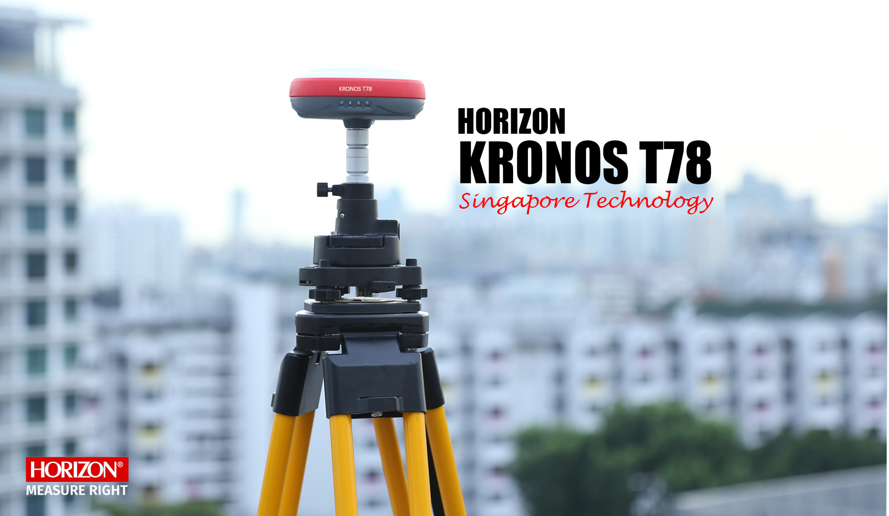
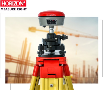
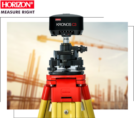
KRONOS T78 is a cutting-edge GNSS receiver for any surveying project. Featuring a new compact case, cutting-edge GNSS technology, industry-leading fast initialization, and uncompromising precision. KRONOS T78 is a GNSS designed to meet and surpass the needs of the modern surveyor.
Key features:
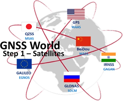
Full Constellation GNSS receiver
Support 1408 channel
New-generation high-performance mainboard
Internal radio with a range of up to 15 km
Multi-Protocol internal radio
High-precision IMU
On-board multipath mitigation
Bluetooth(TM) 5th Generation Connection
high performance in challenging environments
Support 4G network
Web User Interface software
New Technologies
The Kronos T78 is equipped with everything necessary to achieve high accuracy in your mapping project. Its new mainboard and technology assist in performing well in challenging environments. It is integrated with state-of-the-art onboard technology for multipath mitigation, low-elevation tracking, and a new algorithm to achieve high accuracy over long distances.
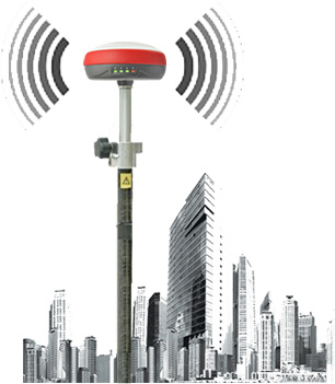
Long range radio
with the new internal radio of the T78, distance is no longer a concern. The radio, utilizing 410-470 MHz Horizon technology, allows for a working range of up to 15 km. It supports multiple protocols, making it compatible with various brands. The ability to manually edit channels and match them with other radios allows for complete customization of the internal radio on the Kronos T78.
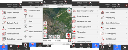
Professional Software
The Map Pro software is a powerful and versatile GNSS and mapping software that can handle all your needs, such as using Google Maps or WMS Maps, exporting in various formats like SHP, DXF, GPX, or KML, using Cad to stake out points, collecting points through RTK, static, PPK, or N-RTK, or collecting or staking out points with precise IMU without the need for stand leveling on your point.
Powerful at tracking Satellite Signals
The Kronos T78 employs the advanced Horizon technology, which features 1408 channels, allowing it to track all positioning satellites such as GPS, GLONASS, BeiDou, and Galileo with high accuracy. The new design ensures greater precision even in challenging environments, enabling you to complete your surveying quickly and reliably without any concern
Because the KRONOS T78 has a high-tech, long-range internal radio with a range of up to 15 km, it eliminates the need for an external radio in many projects. The internal radio uses multi-protocol technology and can be matched with any radio between 410 and 470 MHz. This means you can easily enter your base frequency into your rover device without any limitations.
Long Range Internal Radio (410-470 MHZ)
multi protocol Like Trimtalk 450s | Trimtalk III | Horizon15 |Satel range work up to 15km Low noise technology manually input frequency Tx/RX mode
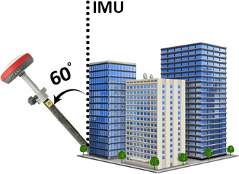
IMU-RTK GNSS
Techniques for Quick and Accurate Mapping: There is no need to level your pole, you can collect accurate data while walking. The Kronos T78 is equipped with a high-accuracy IMU, which enables collecting points without pole leveling up to 60 degrees. This allows for easy measurement of each point with high accuracy, without the need for calibration.
Precision IMU GNSS
Measure point with IMU technology up to 60 degrees. Measure and stake out points without leveling the pole. Fast and accurate measuring in a hard environment. There is no need to calibrate like on the old model.
Powerful mapping Software
Map Pro Software is designed for professionals and beginner surveyors with a customizable interface, offering user-friendly, simple software with high capability. Map Pro supports Google Maps and WMS Maps, allows you to stakeout on your DXF map, and enables you to export your collected data in a variety of formats and extensions.
Professional Surveying Software
Support for static | RTK | PPK | N-RTK | UHF-RTK IMU stores point up to 60 degrees Global Coordinate Systems Library Google Satellite and Vector Map | Open Street Map Comprehensive import/export format map: SHP|DXF|KML|KMZ|GPX|TXT|CSV Stakeouts include points, lines, surfaces, cad stakeouts, and road stakeouts. The entire Tools menu: offset point, resection, intersection, or extension point Site-Calibration wizard NMEA output for connecting to an echosounder voice and audible prompts Multi Languages
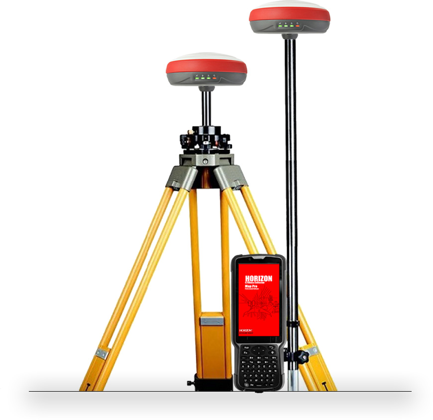
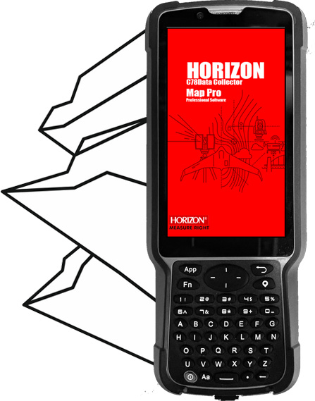
Professional and Rugged Android Controller
The S60 pro is a new controller that is versatile for any working environment and can rust. S60 pro comes with an impervious battery for working all day and mapping. This controller has IP67 protection and is as tough as a rock. S60 Pro supports SIM cards for internet connectivity, the keyboard on S60 Pro makes it easier to type and enter codes, and it is protected by a hard cover.
Rugged and Resilient Support Android 11.0. 5" sunlight-readable display 5-point capacitive touch screen 700 mAh batteries last 36 hours. Bluetooth 5.0 (BLE) generation Fast chargers are supported. IP67 standard G sensor, ambient light sensor, proximity sensor, compass equipped with a rear and front camera for geotagging data.
Professional Surveying Software
Kronos T78, equipped with advanced hardware, is an excellent solution for surveyors in need of a comprehensive GNSS device. Its new main board can track all satellites with 1408 channels, and the addition of a new radio extends its working range to up to 15 kilometers. This means there is no longer a need for an external radio, making it suitable for covering a wide range of projects. The Map Pro software accompanying the T78 is user-friendly and offers a complete solution for your mapping needs, including an IMU option that eliminates the need to keep the device level at each point. This device is a valuable asset for any surveyor
Shipping & Delivery
MAECENAS IACULIS
Vestibulum curae torquent diam diam commodo parturient penatibus nunc dui adipiscing convallis bulum parturient suspendisse parturient a.Parturient in parturient scelerisque nibh lectus quam a natoque adipiscing a vestibulum hendrerit et pharetra fames nunc natoque dui.
ADIPISCING CONVALLIS BULUM
Vestibulum penatibus nunc dui adipiscing convallis bulum parturient suspendisse.
Abitur parturient praesent lectus quam a natoque adipiscing a vestibulum hendre.
Scelerisque adipiscing bibendum sem vestibulum et in a a a purus lectus faucibus lobortis tincidunt purus lectus nisl class eros.Condimentum a et ullamcorper dictumst mus et tristique elementum nam inceptos hac parturient scelerisque vestibulum amet elit ut volutpat.