HORIZON PHOTON 100

HORIZON PHOTON 100

All in one Package, Smart and Accurate

Photon 100 a compact and lightweight LiDAR point cloud data acquisition system that is integrated with Livox's new-generation laser scanner, GNSS and IMU positioning and attitude determination system, and a storage control unit. This advanced technology enables the system to dynamically and massively collect high-precision point cloud data and rich image information in real-time. Additionally, with a 26mp camera integrated into the sensor, the Photon 100 is capable of producing color-rich and detailed point clouds, Photon 100 is most cost effective LiDAR system and making it an ideal choice for industries such as surveying, electricity, forestry, agriculture, and land planning for acquiring 3D spatial information with utmost accuracy."

Key features:

  • Scanning radius of up to 250m
  • Support Triple echoes, 720,000 Points/Sec
  • IMU Accuracy: Pitch/Rolle: 0.015° | Head 0.40°
  • GNSS: GPSL1/L2/L5 GLONASSL1/L2 BDS B1/B2/B3 GAL E1/E5a/5b
  • Lightweight LIDAR sensor with built in 26mp camera
  • Easy mounting on DJI drones and most other drones.
  • Multi-platform, can be mounted on both drones and vehicle
  • Application: Forestry, Power line, Mine, Urban…
  • Light weight 1kg.

Advanced Accuracy

PHOTON 100 uses high-accuracy IMU to sense pitch, roll, and heading and multi-frequency GNSS for precise positioning. With all the crucial components integrated into one system, the PHOTON 100 is a high-cost effective solution that delivers optimal accuracy for your LiDAR projects.

Easy mounting

PHOTON 100 is its compatibility with various drones, including DJI Drone models like Matrice 300,350 and Matrice 210. Additionally, mounting the PHOTON 100 on other drones is quick and effortless, with no limitations on multirotor, fixed-wing, or VTOL drones.

User friendly Operation

The PHOTON 100 is an incredibly user-friendly device, making it an ideal choice for both professionals and those new to working with LiDAR. With its easy-to-use design, you can quickly mount on your drone and start your project with confidence..

High-Density Point Cloud, High-Precision IMU, and GNSS for Exceptional LiDAR Results

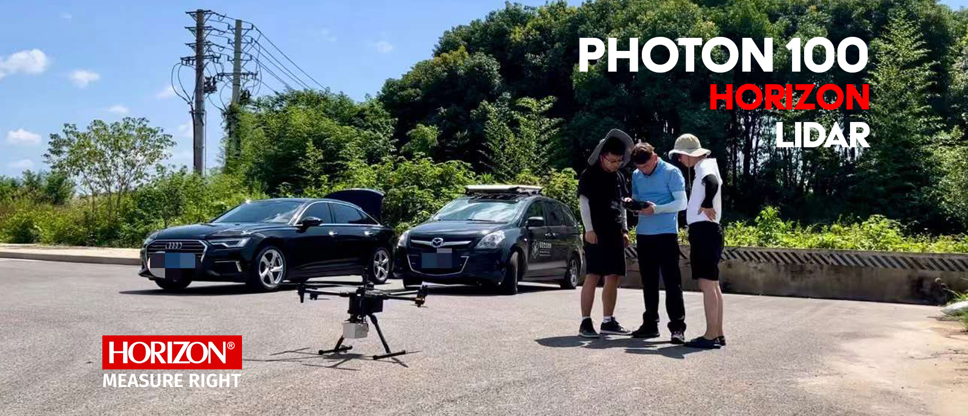
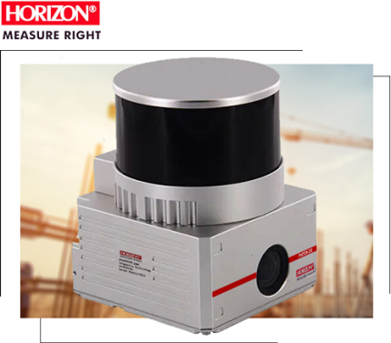
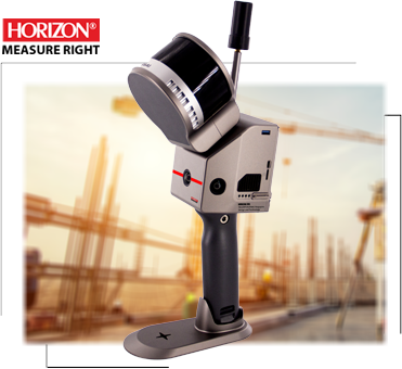
The PHOTON 100 is a good for variety application or professional and beginner surveyor wants enter in this industry, With its triple echoes laser system, it can collect up to 720,000 points per second, resulting in a high-density point cloud for superior mapping accuracy. Its high-precision IMU with an update frequency of 200KH and an accuracy of Pitch/Roll: 0.015° | Head: 0.040°, combined with an industrial-grade GNSS, ensures high-quality Lidar data collection. The high-accuracy INS is essential for collecting accurate Lidar data, allowing the PHOTON 100 to deliver an absolute accuracy of 5 to 10 cm. Additionally, users can further improve accuracy and precision by applying adjustment algorithms in the software.

For advanced accuracy in Lidar, look no further than the PHOTON 100

High efficiency in Design

Photon 100 follows a lightweight design to maximize efficiency when used on drones. This LiDAR system weighs only 1 kg, allowing for extended flight times and greater area coverage.

The Photon 100 LiDAR is fully compatible with a wide range of drones, without any limitations. It can be easily mounted on both fixed-wing and VTOL drones, offering versatility and flexibility in your data collection tasks

Built in Camera

The Photon 100 is equipped with a 26MP internal camera featuring an 83-degree field of view (FOV). This camera excels at capturing vibrant, detailed point clouds, enhancing the richness of your data with true-to-life colors. This option significantly improves the level of detail in your point cloud images.

In a Nutshell...

The PHOTON 100 is an ideal choice for professionals and beginners alike who seek high-quality centimeter-level accuracy LiDAR data. With its triple echoes laser system, high-precision IMU, and Multi constellation GNSS, the PHOTON 400c delivers superior mapping accuracy and reliable data collection. Its stable and easy mounting system makes it compatible with a wide range of drones, making it a highly cost-effective option in its class. Whether you're conducting power line inspections, topographic mapping, emergency response, or forestry surveys, the PHOTON 400c is a powerful tool for your geospatial reality capture needs.

Start typing to see products you are looking for.