HORIZON TORNADO H6

TORNADO H6

long flight time by userfriendliest Drone

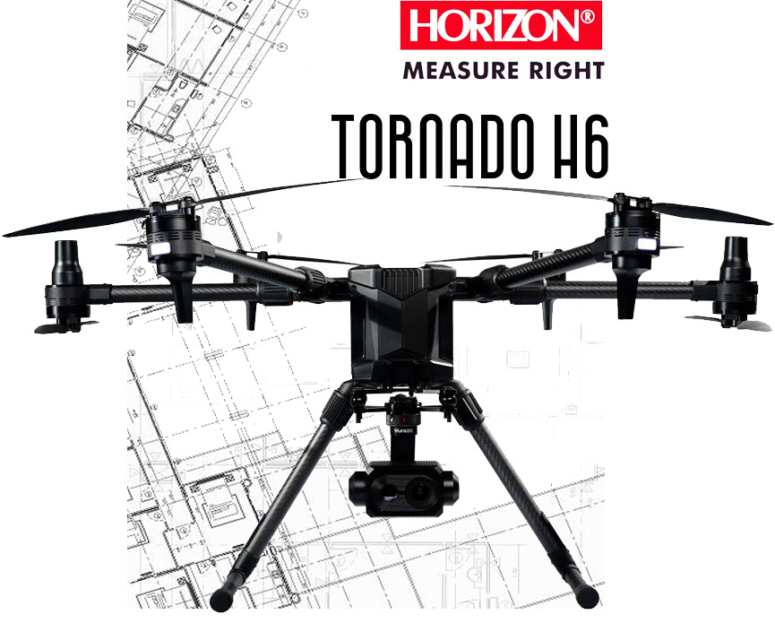
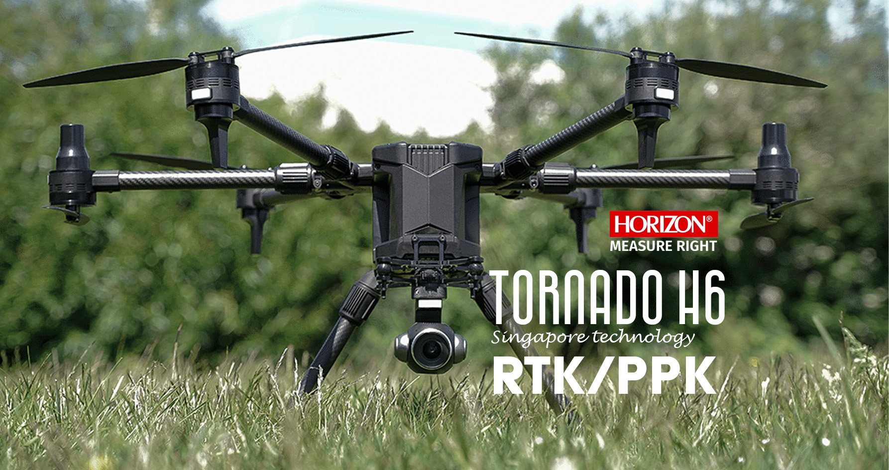
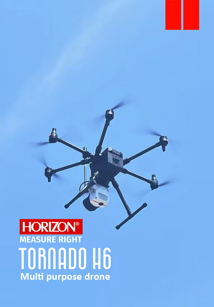
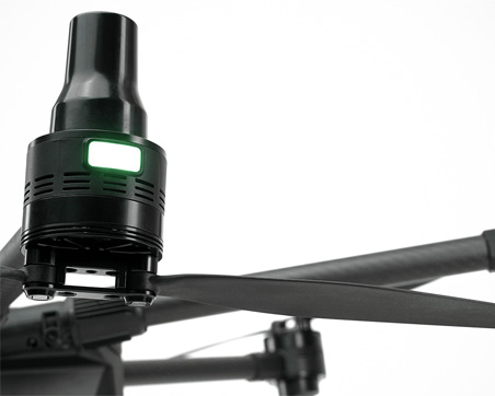
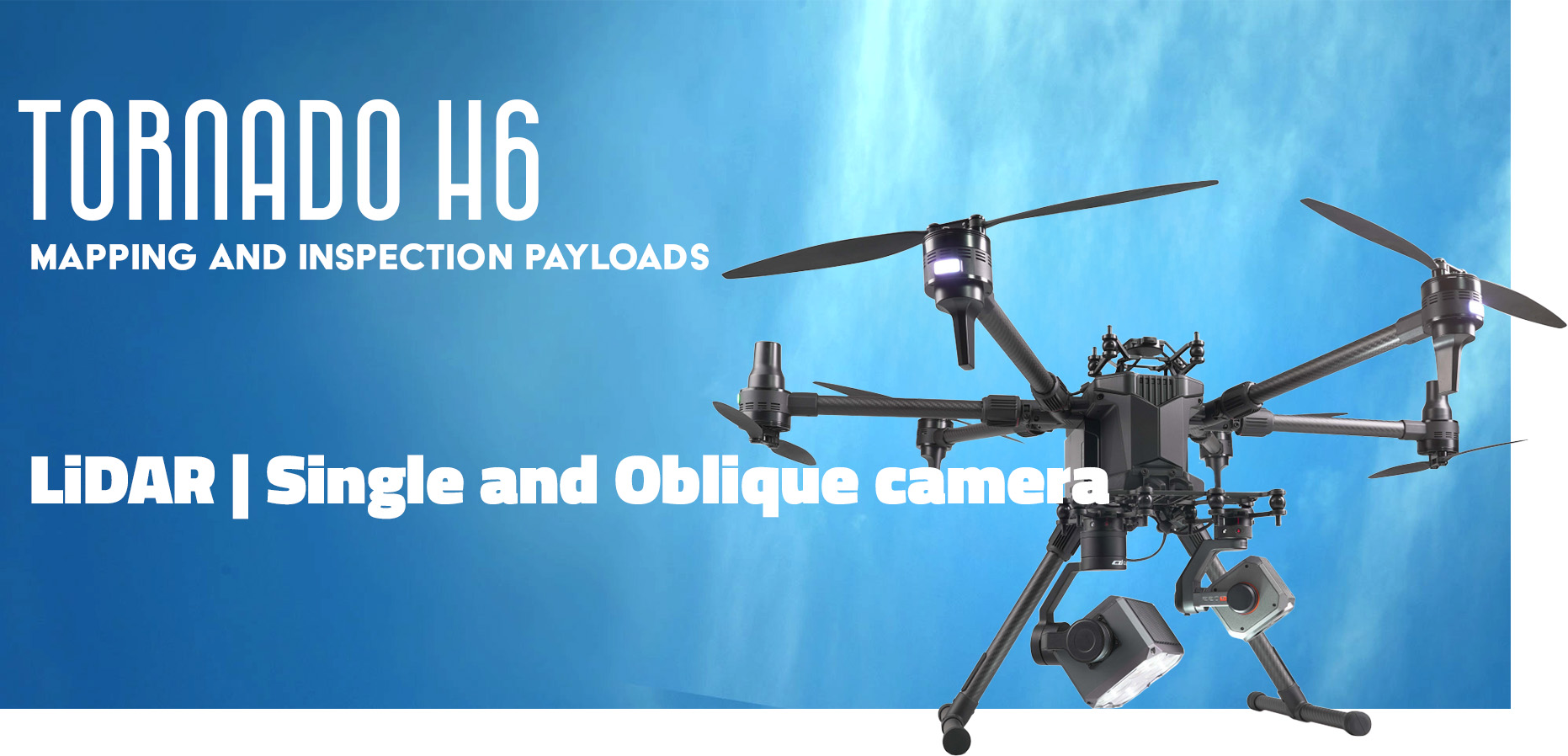
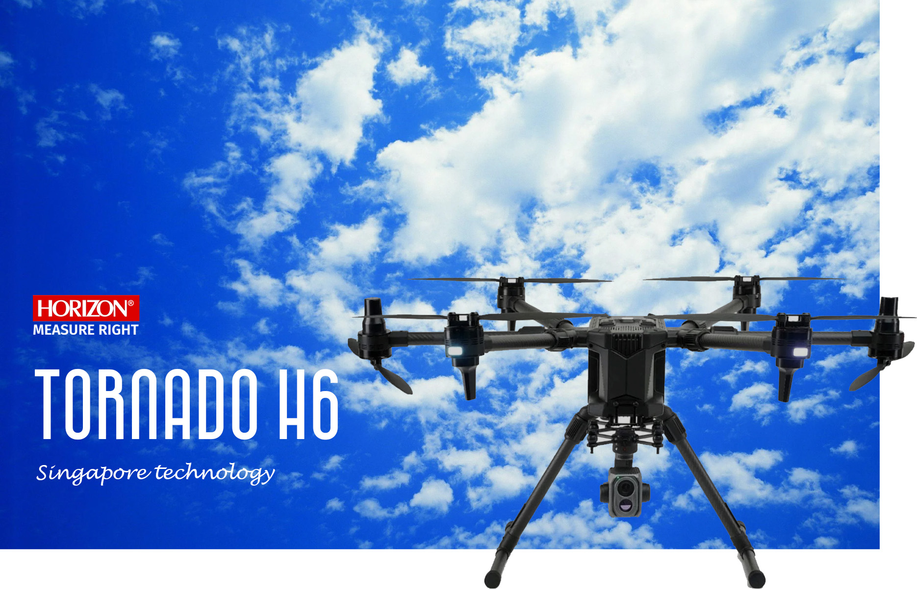
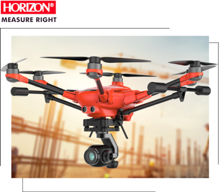
The TORNADO H6 is a versatile and professional mapping and inspection drone designed for multiple purposes. It boasts an impressive flight time of up to 60 minutes and is equipped with an RTK/PPK module featuring dual antennas, ensuring safe and accurate navigation for mapping purposes.

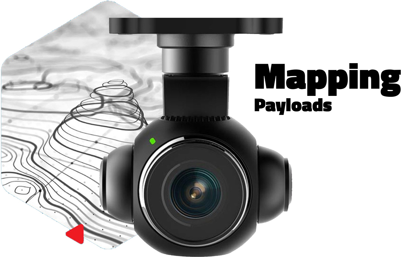
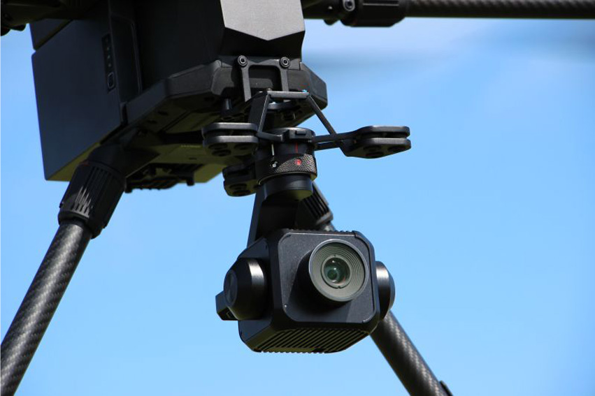
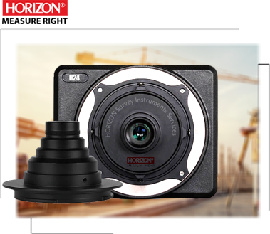
This drone supports a variety of mapping payloads, including single cameras, oblique cameras, LiDAR, and multispectral sensors, all of which can be customized to suit your project's specific requirements. Additionally, all cameras come with a 3-axis gimbal for enhanced accuracy.

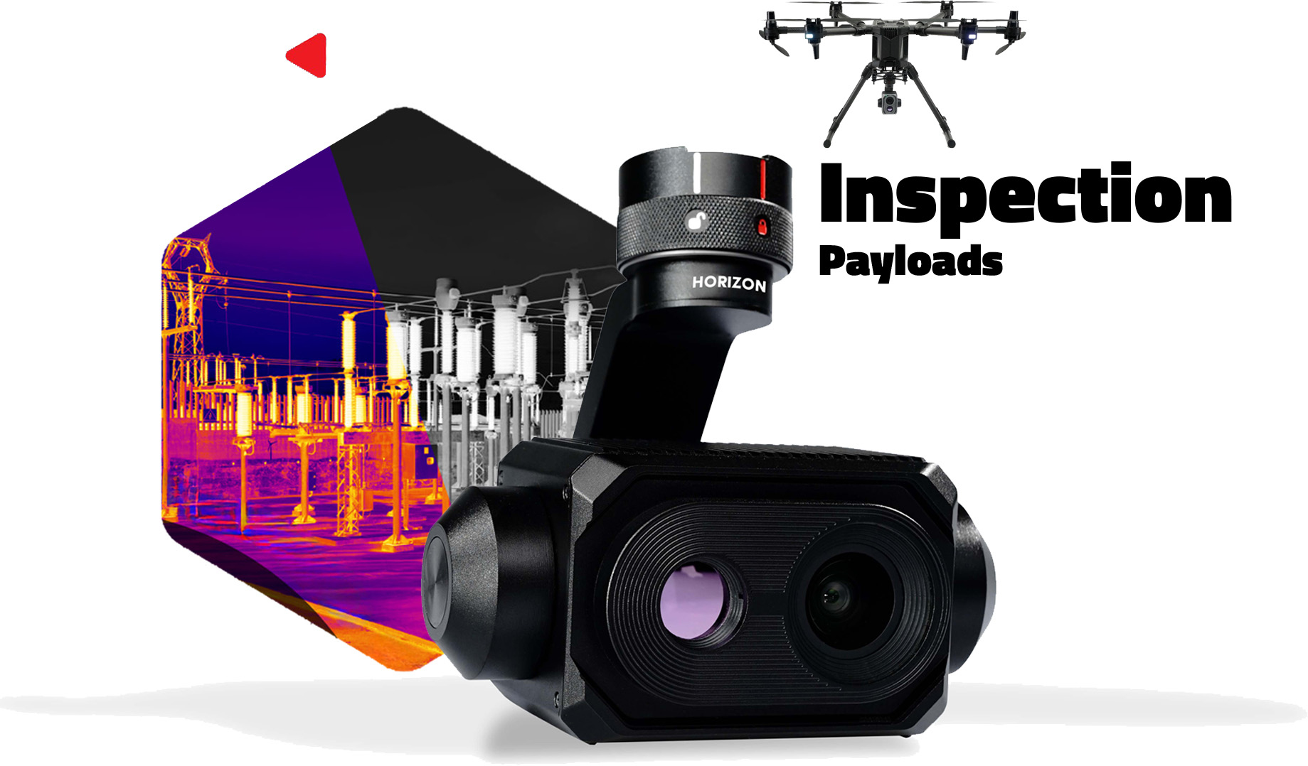
The TORNADO H6 also accommodates various inspection payloads, such as thermal, zoom, and gas detectors, making it a versatile choice for a wide range of inspection tasks.

Key features:

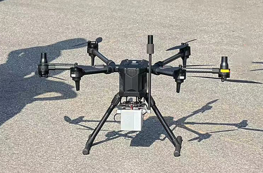
  • Safe fly with 6 rotors (5 rotor fail-safe)
  • Flight time 60min
  • Diagonal length 850mm
  • Advanced 3 axis Gimbal
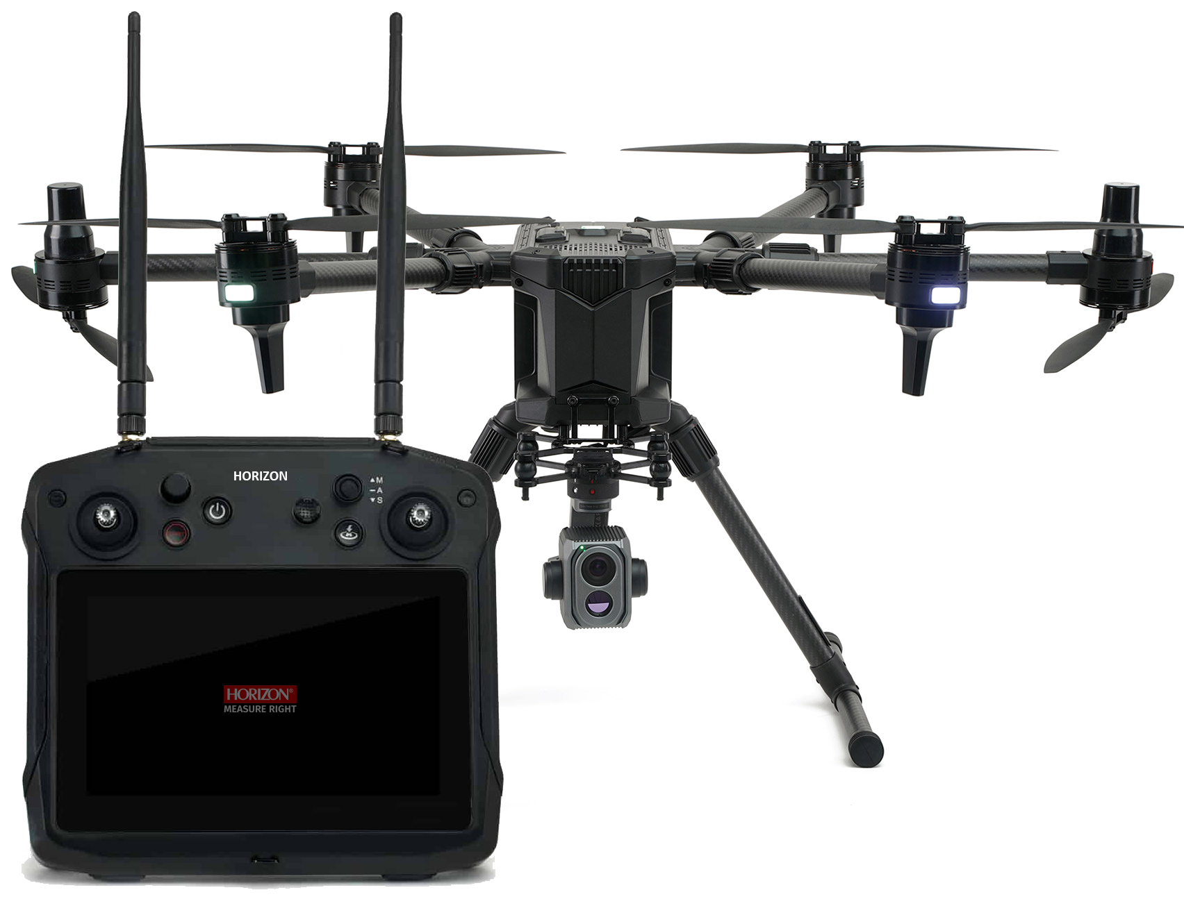
  • EQuipped with Dual RTK Antenna
  • Support RTK/PPK and Network RTK
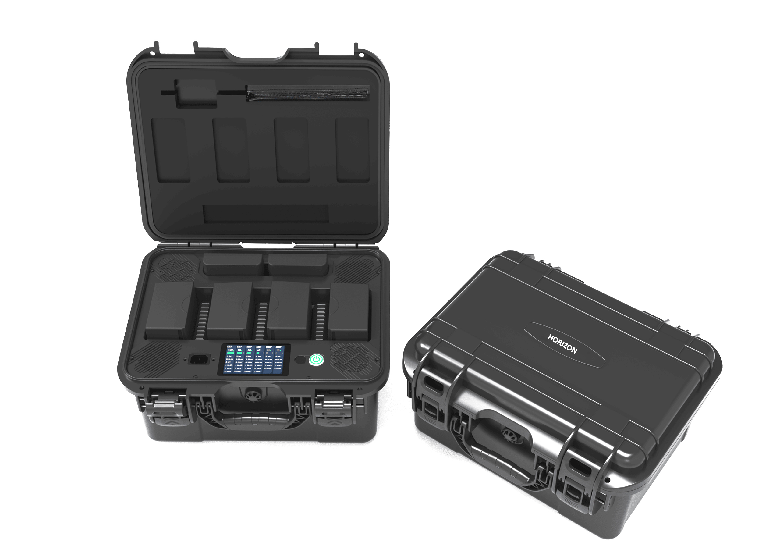
  • Easy Swappable payload Mapping and Inspection camera
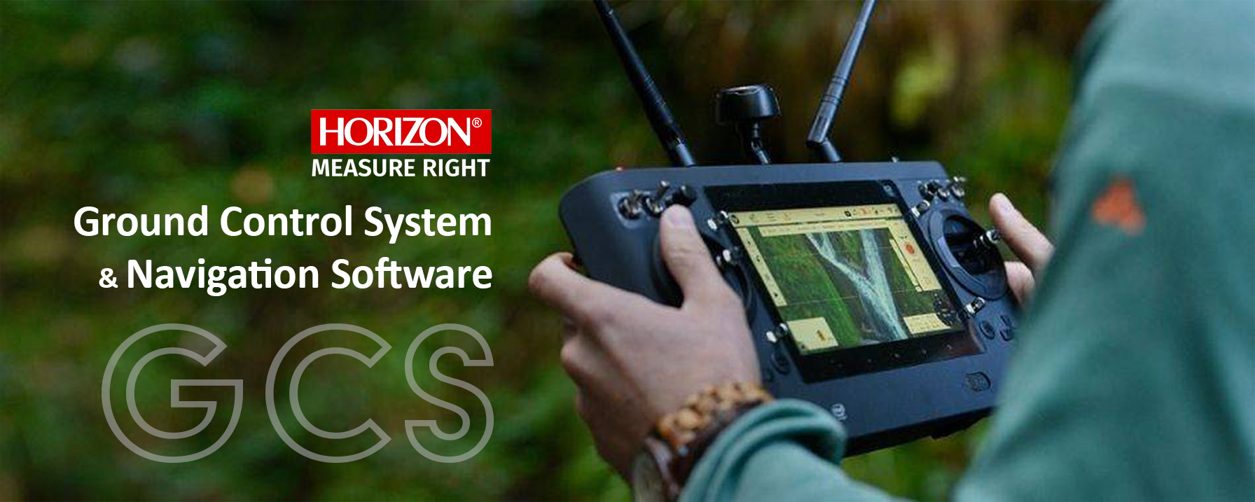
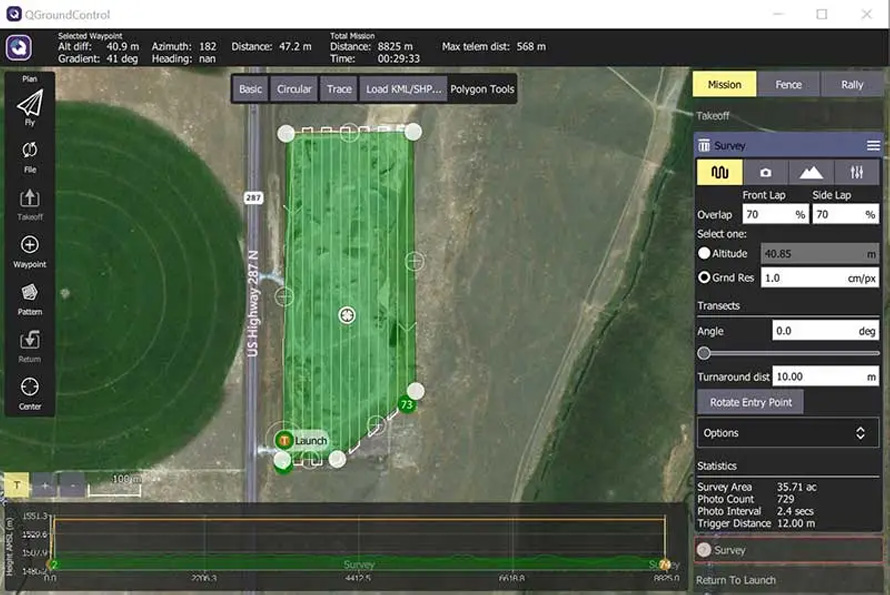
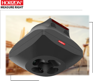
  • Intelligent 7” ground control system
  • Support Google map and import KML map design Route
  • Radio communications stating 15 km range
  • Application: Mapping, Inspection

Multi porpuse drone

The TORNADO H6 is designed for mapping and inspection tasks with an easily swappable payload system. Its compact design allows for portability, making it a versatile and portable drone. Equipped with a 3-axis gimbal, payload camera include: Single camera,Oblique camera, LiDAR, Thermal camera, Zoom camera, Spot lite, Air pollution sensor

RTK/PPK and NRTK module

For mapping and accurate navigation purposes, the TORNADO H6 is equipped with a precise RTK/PPK multi-frequency module by Dual Antenna. This module supports Network RTK or Base Station with a 5 Hz update rate of position, velocity, and time and can perform exceptionally well even in challenging environments.

Route planning Software

With TORNADO H6's route design planning software, you can easily plan missions on Google Maps or import your KML files into the software. This software supports orbit flights, waypoint flights, cross design flights, ... It allows you to check time, area, and many other options within your software and Ground Control Station (GCS)

HORIZON
TORNADO H6

All in one, mapping and Inspection

The TORNADO H6 is designed for safe flight with its six rotors, ensuring that even if you lose one motor, you can still land safely without experiencing a crash. This drone serves two primary purposes:

Mapping: The TORNADO H6 is equipped with an RTK/PPK module for mapping and supports CORS stations. It also comes with a single camera available in two versions: 45mp and 61mp both with a 3-axis gimbal, also support oblique camera and LiDAR, . Additionally, it offers user-friendly software for designing the best flight routes for area coverage.

Inspection: The drone's easy swappable payload system allows for various inspection payloads with a 3-axis gimbal, including thermal cameras, zoom cameras, spotlights, and air pollution sensors.

RTK | PPK Module

Fast and Accurate positioning module

The Tornado H6 features a multifrequency GNSS module that supports both RTK and PPK solutions by Dual antenna . With a 5Hz module, it can achieve high accuracy for geotagging pictures. Equipping this module results in a reduction of control points and an increase in accuracy across your entire area. This directly impacts project timelines, project costs, and overall accuracy.

Mapping Camera

Single camera and Oblique camera

The TORNADO H6 is equipped with single cameras, with 45MP (Full frame) ,by featuring a mechanical shutter and high-quality lenses designed for mapping. this camera include a 3-axis gimbal to achieve high picture quality for your mapping project. Additionally, the TORNADO H6 can be equipped with an oblique camera with options for 305MP, 210MP, or 120MP, and support multispectral camera.

Mapping Camera

LiDAR solution for 3D mapping

The TORNADO H6 can utilize the PHOTON LiDAR series for highly accurate and dense scanning of various objects. All PHOTON LiDAR units are fully compatible with the TORNADO H6 to ensure the creation of the best 3D models.

Each PHOTON LiDAR device is equipped with a 26MP internal camera, which aids in optimizing LiDAR scanning by adding color to the point cloud. This allows for more precise object detection and analysis

The TORNADO H6 H6 is equipped with an advanced thermal camera, zoom camera, and spot light payload designed for inspections. All inspection cameras come with a 3-axis gimbal, providing you with full control over your projects. The advanced thermal camera ensures higher-quality pictures and videos with 4K resolution for your search and rescue missions or any other projects. The TORNADO H6 is suitable for various applications, including building inspections, solar panel assessments, and power line examinations. It is also an ideal choice for search and rescue operations, firefighting, and law enforcement.

This drone is equipped with reliable obstacle avoidance technology, providing enhanced safety, especially when operating in urban areas or busy locations. It features a 7-inch intelligent ground control station and user-friendly software for mission planning and overall control. The Kestrel is a great choice for both beginners and professional surveyors, as well as those looking to perform inspections

Ground Control System

The Ground Station is an all-in-one transmitter and receiver, offering complete control over the TORNADO H6 during flight and enabling users to design and plan missions. Featuring a spacious 7-inch integrated screen, this Android-based controller displays real-time flight footage, eliminating the need for an external device. Additionally, you can use the Ground Control Station (GCS) as a mission planner. Plan your flight using the touchscreen interface and execute your mission with a single button press.

This Controller equipped with Data link communication with 15km range.

Mission Planning Software

mission planning software empowers you to design your route using Google Maps or by importing KML files. This software allows you to customize camera settings, including overlap, altitude, and accuracy. Once your route is designed, you can assess the coverage area and calculate the number of photos required. You have control over flight time and all aspects of the mission.

Our software supports spiral routes and enables terrain-aware flight planning. You can manage accuracy and altitude simultaneously within the software, providing a comprehensive and intuitive solution for your mission planning needs

Charging Station

charge batteries fast and safe

TORNADO H6 is equipped with a charging case for charging four drone batteries and two controller batteries. This charging station helps to charge all batteries at the same time and in the best condition, decreasing the battery life and ensuring safe battery transport anywhere. You can control all batteries during the charging process with this station

In a Nutshell...

The TORNADO H6, boasting a 60-minute flight time and six motors, is well-suited for a wide range of projects, ensuring safe and reliable flights. Equipped with a 45MP camera for mapping solutions, it can fly at altitudes exceeding 300 meters while maintaining precision and capturing every detail.
The drone supports easy swapping of payloads, allowing you to mount and use other equipment like oblique cameras or LiDAR sensors. All single cameras come with 3-axis gimbals, ensuring the quality of each captured image.

TORNADO H6 employs high-accuracy RTK/PPK sensors and supports Network RTK, enhancing accuracy and reducing the need for ground control points (GCPs). This user-friendly, multipurpose drone is adaptable to various projects, making it a valuable tool for your needs.

Start typing to see products you are looking for.