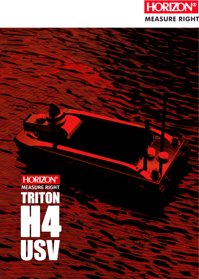
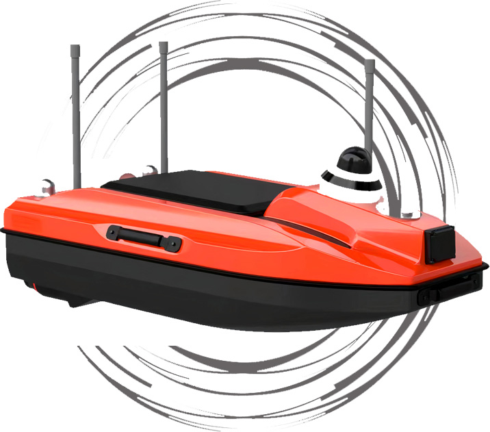
TRITON H4
TRITON H4
Professional All-Purpose USV for Hydrography Surveys.
One man system Hydrography USV
Triton H4 is Advanced USV for Hydrography with excellent portability and capability. Equipped with Autopilot, multi frequency GNSS, and a powerful Windows Remote Controller, this USV offers exceptional accuracy and reliability. the TRITON H4 has a large interior volume for flexible payload options,Like Single and Dual frequency echosounder, Side scan Sonar or LiDAR, Trust the TRITON H4 to get the job done, day in and day out.
Key features:
- Single-frequency echosounder measures up to 200m.
- Multi-payload: Dual-frequency Echosounder, ADCP, Side-scan sonar, LiDAR.
- Supports RTK positioning with Radio and CORS station.
- Dual antenna for high-performance navigation and accurate heading.
- Data telemetry connection up to 3km.
- 360-degree camera.
- Real-time video and monitoring data.
- Equipped with obstacle avoidance.
- Higher speed, up to 5m/s, and a tangle-free system.
- Automatic mission planning with navigation software.
- Easy swappable payloads for changing the mission.
Flexible
payload
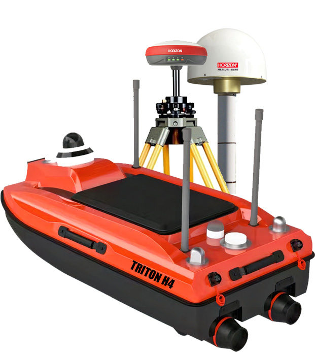
The Triton H4 supports various payloads for Hydrography surveying like Single and Dual frequency echosounder, ADCP, Side scan sonar, LiDAR and is equipped to Obstacle avoidance plus 360 camera to facilitate a full and safe control of the USV in all conditions. The payload can also customized upon request for versatility.
SMART POSITIONING
AND NAVIGATION
TRITON H4 has a standard autopilot feature with GPS navigation and live telemetry for monitoring. It has dual GNSS antennas and interfaces with the RTK system for greater accuracy. TRITON H4 can be connected to the base station with a radio or connected to the CORS station with SIM card.
Design for
highest Stability
The new TRITON H4, with M design and equipped with two robust debris-resistant motors, offers heightened stability in challenging conditions, such as waves and winds, while minimizing noise. Additionally, the TRITON H4 boasts increased interior space, enabling carry more payload.
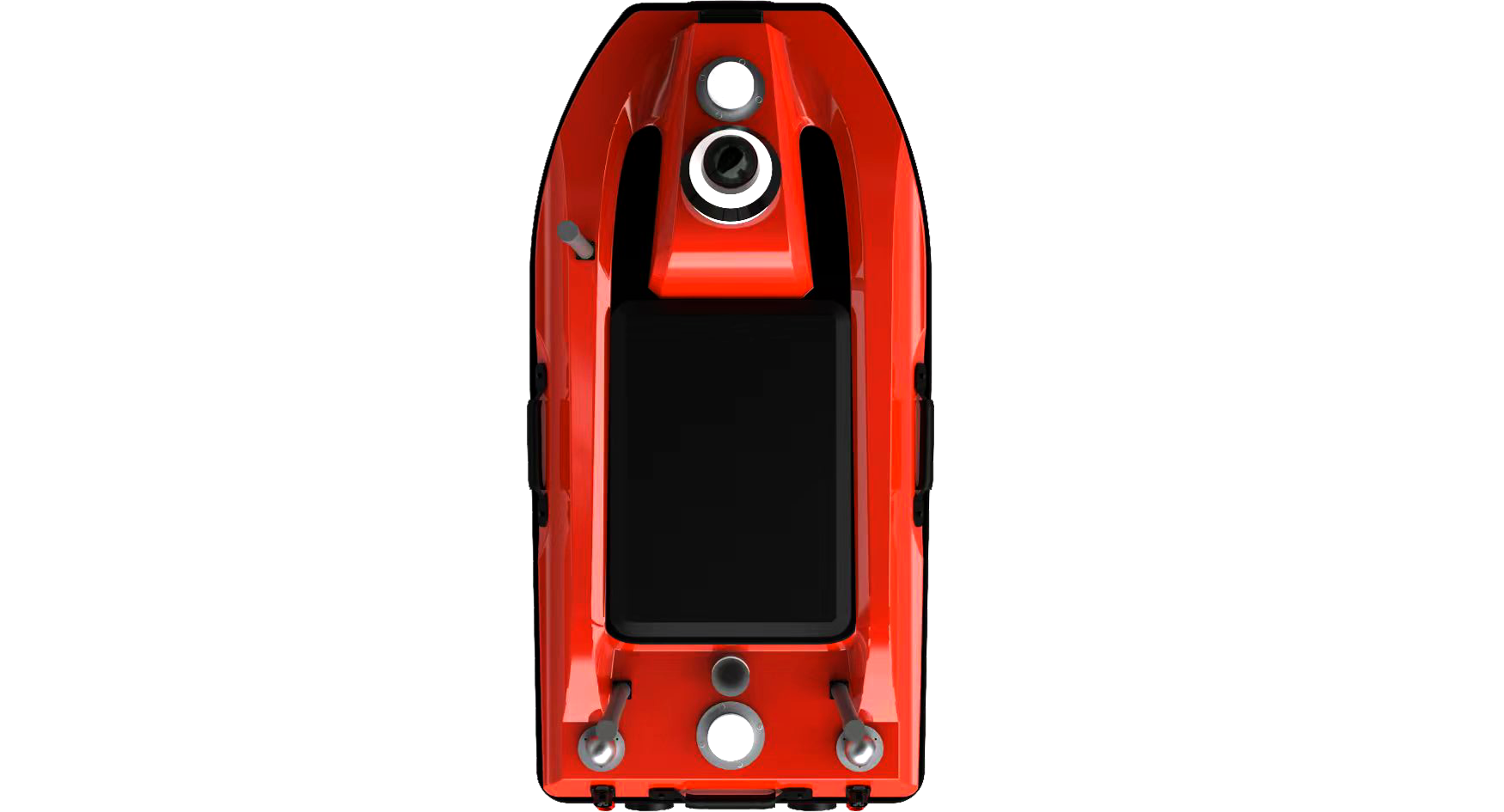
our latest unmanned surface vehicle (USV) designed specifically for surveying and monitoring missions. with new design This advanced USV has the ability to operate in a wide range of water environments, including shallow waters with its lower draft, making it an ideal choice for surveying rivers, lakes, and oceans. The TRITON H4 features a flexible equipment capability, accommodating a variety of survey equipment, including single and Dual frequency echosounder, Side scan sonar, ADCP, LiDAR. The state-of-the-art autopilot system provides precise and reliable navigation, while the long-range wireless communication system allows for real-time data transmission. Trust the TRITON H2 for reliable and effective survey missions.
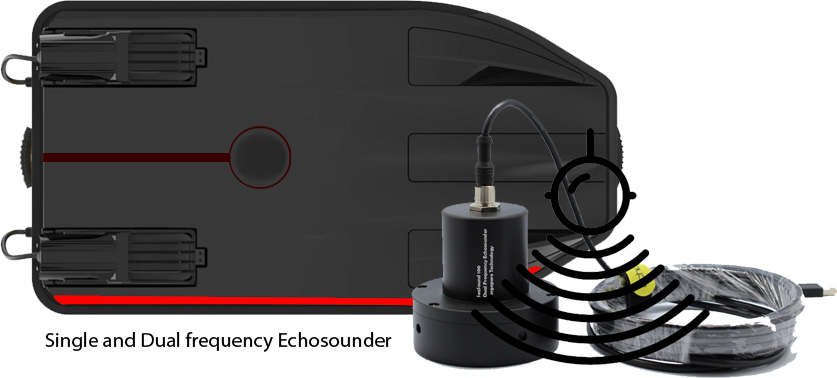
High performance Echosounder
The TRITON H4 uses the advanced echosounder series to provide high-quality depth data. Its proprietary synthetic beam technology achieves much higher horizontal resolution compared to other sounders, resulting in a smaller ensonified footprint that can detect detailed bottom features. This echosounder specifically provides Bottom Contrasting and Sediment View graphic displays for enhanced analysis. Export data can processed in any software like Hypack, Hydro magic, Quinsy .... Additionally, the TRITON H4 uses an echosounder with special protection against interference caused by some motors.
RTK positioning solution
The TRITON H4 USV equipped to the Multi frequency GNSS module for RTK solution, TRITON H4 Support 4g/LTE and N-trip network, it means for reach to Accuracy around 1cm can connected to the base station with internal or eternal radio or can connected to the cors station and get the correction message from the Cors Network.
TRITON H4 also equipped to the two GNSS antenna, this option and RTK solution have a high accuracy result in data and in navigation.
USV can connected to any RTK solution brand without any limitation.
High performance Echosounder
The TRITON H4 is equipped with a 360° security camera and a millimeter-wave radar system to prevent collisions with obstacles. Real-time monitoring is available on the base station, ensuring safety for both your work and your Unmanned Surface Vehicle (USV). Using the obstacle avoidance sensor, the TRITON H4 can detect and navigate around any objects in its path, choosing a safe route or reverting to the original planned route when necessary. All sensors, including IMU, GNSS, and camera, contribute to intelligent and secure navigation with the TRITON H4.
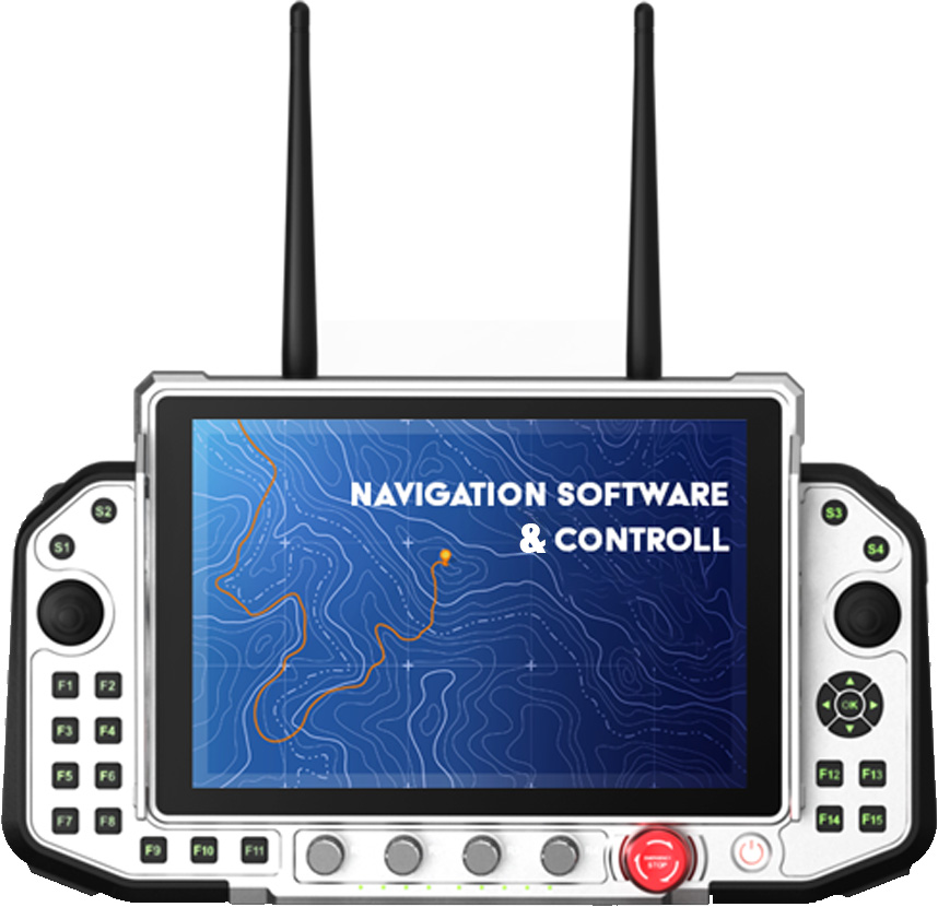
Navigation Software
TRITON H4 offers a high-performance and user-friendly software for navigation and monitoring of your project from your ground station. This software supports Google Maps and KML files, allowing you to import your KML files and design your route in the field... and then start.
This software is not only a navigation tool but also serves as a control center for your project, enabling real-time monitoring. You can control the routes and check the USV's performance. Safety features are integrated so that if any problem arises with the USV, it can automatically return to home. Everything will be under your control.
TRITON H4 also equipped to the two GNSS antenna, this option and RTK solution have a high accuracy result in data and in navigation.
USV can connected to any RTK solution brand without any limitation.
In a nutshell
The TRITON H4 is a versatile small USV equipped with advanced technology for efficient hydrography and bathymetry. It features a variety payload Single and Dual frequency echosounder, ADCP, Side scan Sonar and can also use a LiDAR system. It also includes high-range telemetry and obstacle avoidance for added safety and convenience. Trust the TRITON H4 to deliver accurate and reliable results, as it is a complete solution that requires no additional purchases.