HORIZON PHOTON 200

HORIZON PHOTON 200+

Accurate, High-Density, Colorful Point Clouds

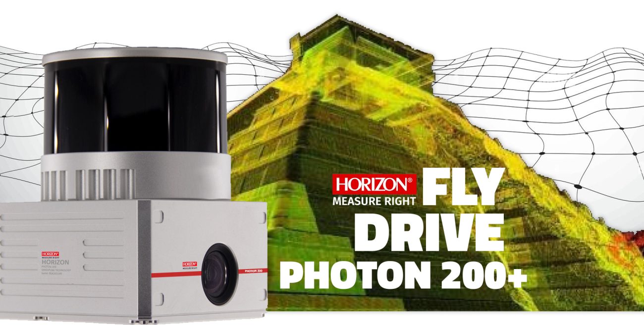
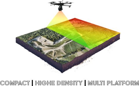
The Photon 200+ is a compact and lightweight LiDAR point cloud data acquisition system integrated with the Hesai Sensor. It is capable of measuring distances of up to 120m with exceptional performance. This LiDAR device can record 1,280,000 points per second with a 200Hz POS unit and features an accurate IMU. As a result, it has become one of the most popular LiDAR systems in the market.

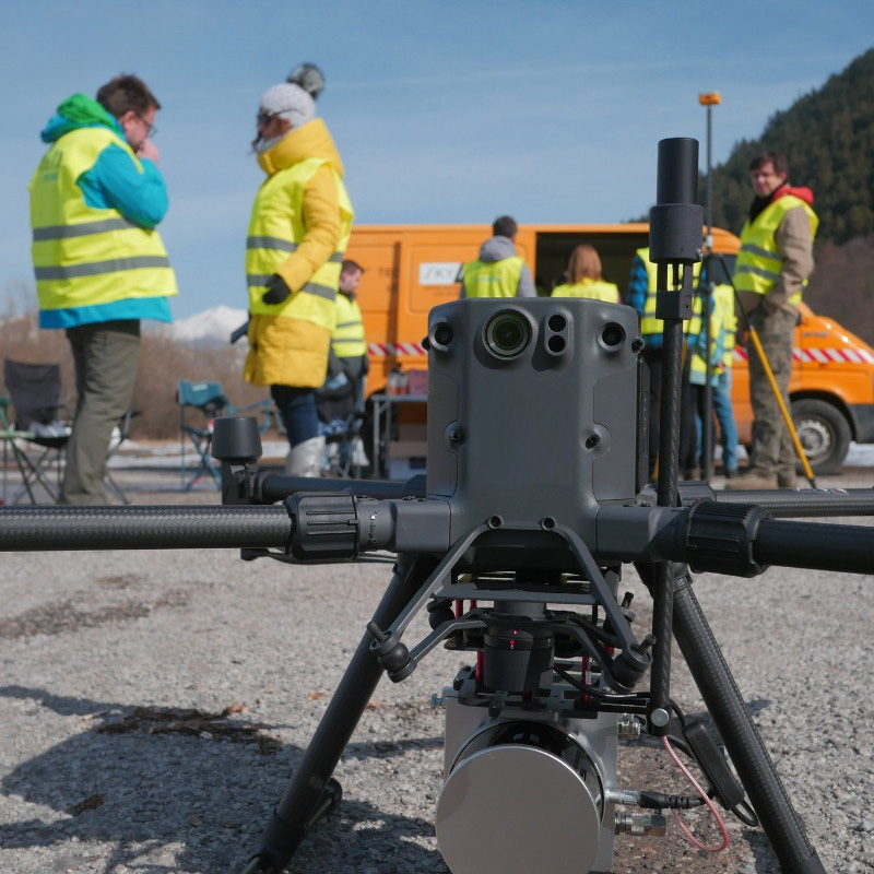
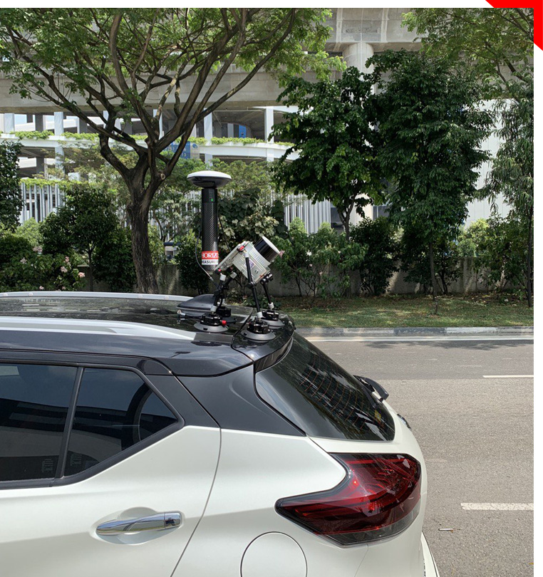
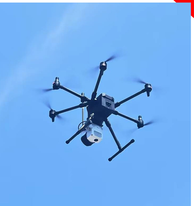
The PHOTON 200+, known for its high-performance capabilities, stands out as a cost-effective LiDAR solution that competes strongly with other LiDAR technologies. What makes it even more versatile is its ability to be mounted on DJI drones and various other drone models without limitations. Additionally, it can also be mounted on vehicles for mobile mapping when used with a car kit.

Key features:

  • Scanning radius of up to 120m
  • Support collecting, 1,280,000 Points/Sec
  • IMU Accuracy: Pitch/Rolle: 0.015° | Head 0.040°
  • GNSS: GPSL1/L2/L5 GLONASSL1/L2 BDS B1/B2/B3 GAL E1/E5a/5b
  • Lightweight LIDAR sensor with built in 26mp camera
  • Easy mounting on DJI drones and most other drones.
  • Multi-platform, can be mounted on both drones and vehicle
  • Application: Forestry, Power line, Mine, Urban…
  • Cost effective with high density data record
  • Light weight 1.4kg.

Advanced Accuracy

PHOTON 200+ uses high-accuracy IMU to sense pitch, roll, and heading and multi-frequency GNSS for precise positioning. With all the crucial components integrated into one system, the PHOTON 200+ is a high-cost effective solution that delivers optimal accuracy for your LiDAR projects.

Easy mounting

PHOTON 200+ is its compatibility with various drones, including DJI Drone models like Matrice 300,350,600,210. Additionally, mounting the PHOTON 200+ on the other drones is quick and effortless, with no limitations on multirotor, fixed-wing, or VTOL drones ALso Vehicle.

User friendly Processing Software

The PHOTON 200+ features user-friendly software for easy data processing and LAS file creation. With one-click data processing, automatic data detection, and optimization options, your point cloud is quickly and effortlessly generated in our processing Software.

HPRIZON
PHOTON 200 LiDAR

Reliable and accurate airborne LiDAR

The PHOTON 200+ UAV Lidar Mapping System boasts a 120m Above Ground Level (AGL) capability, featuring a built-in 26MP RGB camera and an accurate POS system. This combination makes it an ideal choice for various surveying projects. The system seamlessly integrates a Hesai XT32 laser sensor and all the necessary built-in components, giving it a futuristic appearance while excelling in terms of strong penetration and minimal beam divergence. These features position the PHOTON 200 as a top performer in its class of UAV Lidar scanning systems, particularly in challenging vegetation-rich environments

FLY and DRIVE system

The Photon LiDAR system stands out for its versatile sensing and mounting options. The Photon 200+ is specifically engineered for UAVs and is fully compatible with DJI drones. It can also be easily mounted on other multirotor and fixed-wing drones. Furthermore, it offers adaptability for vehicle mounting with a mobile mounting kit, making it ideal for urban and road project scanning

Mounting On Vehicle

The Photon 200, with its vehicle mounting option, so easy to use. You can adjust the angle and attach it to a wide range of vehicles. Additionally, it can be mounted on Unmanned Surface Vehicles (USVs) as well


Mounting On Drone

The Photon 200 is fully compatible with DJI drones, as well as other multirotor and fixed-wing drones. If you have a specialized drone, we can design a custom mounting kit to accommodate your specific needs


Software

User friendley Processing Software

HORIZON
PROCESSING SOFTWRE

One Key Processing Technology

This is a powerful software for point color preprocessing that enables you to creat LAS files. This software autonates the detection of your data and offers seamless processing of trajectory information using IMU, GNSS, and other relevent data source.with its userfriendly interface, Lidar Master makes it easy to optimize your point cloud data.it allows you to generate avisually appealing and accurate 3D models by incorporating color information and integrating all available data sources.

  • Easy to operate
  • Strip Adjust
  • Diverse calculation
  • Autonomous coordinate
  • Fast calculation speed
  • Compatible with most of the LiDAR data
  • Application: Forestry, Powerline, Mine, Urban ....

Application

Forestry, Power Line, Mine, Urban ...

Topographic Mapping
Agriculture & Forestry Survey
Engineering Survey
Volume Calculation
Emergency Mapping
Underground Space
BIM
Power line
Mine mapping

In a Nutshell...

PHOTON 200+ by using accurate LiDAR Sensor and measuring up to 120m with Dual echoes and collect 1,280,000 points/s can be a valuable product for each project . this LIDAR sensor equipped with 26mp camera for creat Colorful point clouds with better vision on model.
PHOTON 200+ can mount it easily on Matric 350,300,210,600 ... and many drones for scanning jobs in forestry, urban, mining, and similar projects or use it for smart city planning and developments.
Photon 200+ is a cost effective with high accuracy in market including Preprocessing software.

Start typing to see products you are looking for.