HORIZON SeaSound100

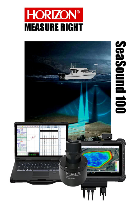
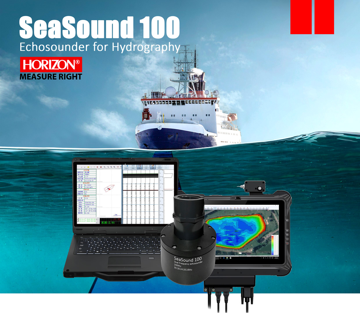
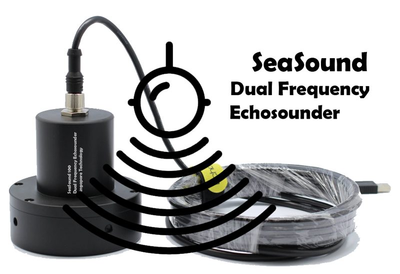
SeaSound 100 Echosounder

Professional and versatile Echosounder

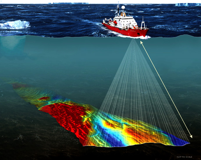
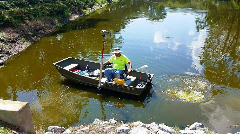
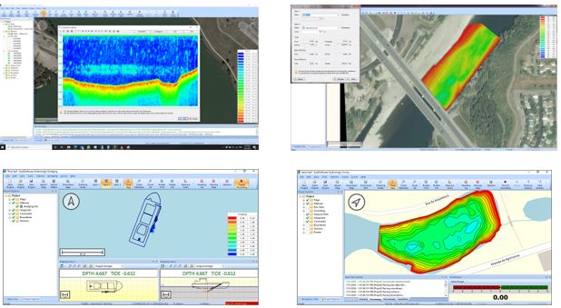
SeaSound 100 Echo Sounder provides accurate water depth measurements in challenging conditions, eliminating external factors that may affect accuracy. It's particularly useful for safe navigation in harbors and waterways with high traffic and measuring silting and floating mud in dredging construction. This technology is a game-changer in the maritime industry, providing reliable and efficient measurements to help marine professionals make informed decisions.

Key features:

  • Measures up to 200m
  • Dual frequencies F1:200 Khz | F2:30 to 10Khz. (Selectable)
  • Ping Rates: 5, 10 or 20hz. (User selectable)
  • Fully compatible with RTK GNSS
  • High performance in shallow water
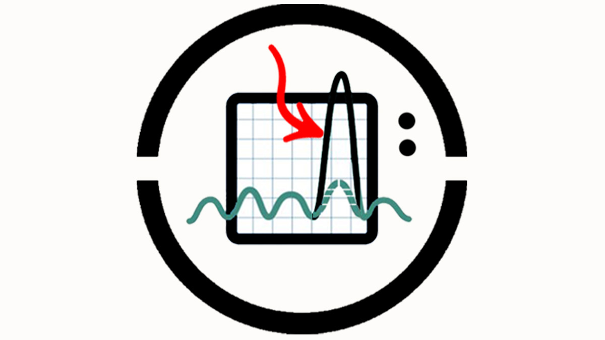
  • Hi-tech Proprietary AI Algorithm
  • Interference Protection Seasound USV
  • Rugged Touch laptop or Tablet

Dual Frequencies 

The SeaSound 100 is an advanced echo sounder that supports dual frequencies, including a wide range in low frequency. This feature is selectable on the field, and it offers below frequencies: F1 at 200 kHz and F2 at 30, 28, 24, 18, 12 or 10 kHz. This technology provides valuable information for hydrographic projects, making it an indispensable tool for marine professionals.

Rugged Laptop

The SeaSound 100 comes equipped with a high-quality, industrial-grade laptop suitable for collecting data in harsh environments. You can choose between a laptop or rugged tablet for your project, both featuring a Core i7 CPU for maximum performance and a touch LCD for ease of use in humid environments.

Process Software

The SeaSound 100 is most compatible with the Hydromagic software, a versatile hydrographic data processor solution with professional specifications that is ideal for use with a dual-frequency echosounder in hydrographic projects..
you can trust to HYdromagic for highest result

More Accuracy More Details

The SeaSound 100 is an advanced sounder that utilizes proprietary synthetic beam technology to achieve a much higher horizontal resolution compared to other sounders. This results in a much smaller ensonified footprint, with a diameter of only 7 inches in the low frequency channel, compared to other sounders' footprints of 6 feet in a ten foot water depth. This allows the SeaSound 100 to detect and display very detailed bottom features that other sounders may miss.

Shallow Water Detection Made Easy

The SeaSound 100 transducer has a unique design that allows for a minimum operating depth of less than one foot, which is not possible with other sounders, due to the "ringing" issue in conventional low frequency transducers that limits their ability to operate at a minimum depth of 5 feet or more.  

High performance Echosounder

The Seasound100 is a versatile payload that offers both a fixed 200kHz high frequency and a user-selectable low frequency, with several options ranging from 10kHz to 30kHz. This wide range of frequencies ensures that the system can be customized to suit a wide range of applications and environments. In addition to its frequency capabilities, the Seasound100 is also unique in its ability to reliably operate in water as shallow as 1 foot. The system's narrow beamwidth on both high and low frequencies (measuring 5 and 3.5 degrees respectively) also ensures accurate data collection in various environments, with minimal need for post-processing. Overall, the Seasound100 is a top-performing payload that offers excellent frequency capabilities and reliable performance in shallow and deep water environments.

Eliminate Manual Editing with the SeaSound Proprietary AI Algorithm

The SeaSound 100 utilizes Unabara's proprietary AI machine learning algorithm for sea bottom tracking, which uses every outgoing ping to anticipate changes in bottom characteristics. This helps to minimize the need for manual editing of bad or missing data before post-processing, unlike other hydrographic mapping software such as HYPACKTM and HydroMagicTM. As a result, it has the lowest data error rate in the industry.

In addition to its superior performance, the motor pod has a longer lifespan compared to other motors used in water-based USVs. With the TRITON H2, you can expect a durable and long-lasting propulsion system that can withstand the rigors of hydrographic surveying.

Processing Software

Our USV is equipped with state-of-the-art Hydromagic software, a professional hydrographic survey software package that is widely used in the marine industry. Hydromagic software is used for data acquisition, processing, and visualization, and can be used with various types of survey equipment. With our USV and Hydromagic software, we are able to perform accurate and efficient hydrographic surveys for a variety of applications.

Our hydrographic survey software, Hydromagic, offers the following features:

  • Built-in editing and filtering of single-beam soundings for accurate and efficient data processing

  • Automatic tide correction using RTK, ensuring precise tide levels without the need for tide tables or gauges

  • Real-time calculation of current tide levels, saving valuable time and improving survey accuracy

  • Support for NADCON, HARN, and NTv2 correction grids, providing flexibility and compatibility with various survey equipment

  • A vast number of exporting options, allowing easy sharing and presentation of survey data

  • Dynamic corrections like draft and sound velocity, enabling accurate measurements and analysis of underwater environments

  • Built-in map downloader for sourcing street map data or satellite imagery, improving survey visualization and interpretation

  • Generation of graphical views of channel cross-sections for comprehensive and detailed survey analysis

  • Compatibility with a large number of map formats, making it easy to import and use map data from various sources.

  • With these advanced features and capabilities, Hydromagic is an essential tool for accurate and efficient hydrographic surveying.

Start typing to see products you are looking for.