TRITON H2

TRITON H2

Professional All-Purpose USV for Hydrography Surveys

Introducing the TRITON H2, a mid-size USV with excellent portability and capability. Equipped with Autopilot, multi frequency GNSS, and a powerful Windows 10 PC, this USV offers exceptional accuracy and reliability. the TRITON H2 has a large interior volume for flexible payload options,Like echosounder, Sonar and all-day operation thanks to its smart battery. Trust the TRITON H2 to get the job done, day in and day out.

Key features:

  • Mid-size Dimension: 140×59cm
  • Support various Payload
  • Support Full GNSS RTK
  • Support 4g/LTE and N-trip network
  • Equipped to Obstacle Avoidance
  • Equipped to camera
  • Long range Lan telemetry
  • Equipped professional echosounder
  • Measure UP to 200m for bathymetry
  • Propulsion: 24lb Thrust Motor Pod
  • Long operation hours of up to 10 hours

Flexible payload

The Triton H2 supports various payloads for Hydrography surveying like dual Frequency echosounder or multi beam echosounder and is equipped to Obstacle avoidance plus camera to facilitate a full and safe control of the USV in all conditions. The payload can also customized upon request for versatility.

Autopilot Navigation

TRITON H2 has a standard autopilot feature with GPS navigation and live telemetry that reduces monotony. It has a GNSS system and interfaces with the RTK system for greater accuracy. TRITON H2 provides unmatched navigational accuracy when it has a fixed solution.

Processing Software 

The TRITON H1 uses the Hydromagic software, a professional hydrographic survey package which can be used to map depth areas using an echo sounder and GNSS receiver. You can process the data collected With TRITON using this software.

USV

our latest unmanned surface vehicle (USV) designed specifically for survey missions. This advanced USV has the ability to operate in a wide range of water environments, including shallow waters with its lower draft, making it an ideal choice for surveying rivers, lakes, and oceans. The TRITON H2 features a flexible equipment capability, accommodating a variety of survey equipment, including multibeam sonar, side scan sonar, and LiDAR. The state-of-the-art autopilot system provides precise and reliable navigation, while the long-range wireless communication system allows for real-time data transmission. With a powerful battery providing all-day endurance, the TRITON H2 delivers exceptional performance and results. Trust the TRITON H2 for reliable and effective survey missions.

High performance Echosounder

The TRITON H2 uses the advanced SeaSound echosounder series with dual frequencies to provide high-quality depth data. Its proprietary synthetic beam technology achieves much higher horizontal resolution compared to other sounders, resulting in a smaller ensonified footprint that can detect detailed bottom features. The SeaSound 100+ model specifically provides Bottom Contrasting and Sediment View graphic displays for enhanced analysis. With the HYDROMAGIC process software, the TRITON H2 can present these displays and utilize the echosounder's advanced capabilities. Additionally, the TRITON H2 uses an echosounder with special protection against interference caused by some motors.

Navigation Software

TRITON H2 Equipped an autopilot with GPS navigation and live telemetry as standard equipment. you can design your mission on google map and upload on software or you can design in a filed.

The autopilot greatly reduces the monotony of creating straight transects. The Autopilot and TRITON H2 are equipped with a navigational GNSS system; however, if purchased with an HORIZON RTK GNSS, the autopilot will be interfaced with the RTK system and will automatically choose the more accurate source for navigation. When the TRITON H2 has a fixed solution, navigational accuracy is unmatched.

Long-Range Bridged LAN Data Link

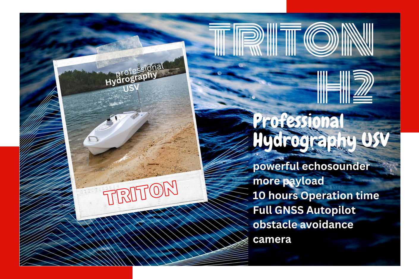
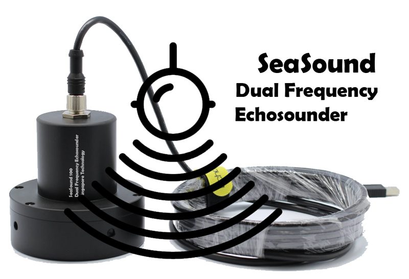
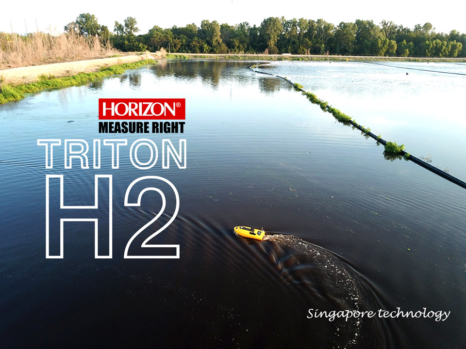
The TRITON H2 USV is a highly advanced tool for Hydrography and bathymetry. One of its key features is the long-range bridged LAN data link, which allows for seamless communication between the boat and the shore.

Operators can remotely access all the equipment onboard the boat using the TCP/IP link provided by the long-range bridged LAN data link. This enables them to use Remote Desktop to upload new missions, transfer survey data, check the camera of boat and perform other tasks quickly and efficiently. The drag-and-drop feature makes it easy to copy survey data from the boat to your shore laptop or office PC.

Overall, the long-range bridged LAN data link feature on the TRITON H2 USV ensures efficient data transfer and remote access, saving operators time and providing a seamless experience.

High quality Pod Motors

The TRITON H2 utilizes a high-powered, corrosion-proof motor pod for efficient and reliable propulsion. Unlike thrusters, the motor pod is steerable and less likely to become stuck in aquatic vegetation, making it the ideal choice for hydrographic surveying in a variety of environments.

In addition to its superior performance, the motor pod has a longer lifespan compared to other motors used in water-based USVs. With the TRITON H2, you can expect a durable and long-lasting propulsion system that can withstand the rigors of hydrographic surveying.

USV

Processing Software

Our USV is equipped with state-of-the-art Hydromagic software, a professional hydrographic survey software package that is widely used in the marine industry. Hydromagic software is used for data acquisition, processing, and visualization, and can be used with various types of survey equipment. With our USV and Hydromagic software, we are able to perform accurate and efficient hydrographic surveys for a variety of applications.

Hydromagic key features:

  • Built-in editing and filtering of single-beam soundings for accurate and efficient data processing

  • Automatic tide correction using RTK, ensuring precise tide levels without the need for tide tables or gauges

  • Real-time calculation of current tide levels, saving valuable time and improving survey accuracy

  • Support for NADCON, HARN, and NTv2 correction grids, providing flexibility and compatibility with various survey equipment

  • A vast number of exporting options, allowing easy sharing and presentation of survey data

  • Dynamic corrections like draft and sound velocity, enabling accurate measurements and analysis of underwater environments

  • Built-in map downloader for sourcing street map data or satellite imagery, improving survey visualization and interpretation

  • Generation of graphical views of channel cross-sections for comprehensive and detailed survey analysis

  • Compatibility with a large number of map formats, making it easy to import and use map data from various sources.

  • With these advanced features and capabilities, Hydromagic is an essential tool for accurate and efficient hydrographic surveying.

In a nutshell

The TRITON H2 is a versatile mid-size USV equipped with advanced technology for efficient surveying. It features a dual-frequency echosounder and sonar, and can also use a multi-beam system. With a long battery life of up to 10 hours, the TRITON H2 is capable of completing projects quickly and efficiently. It also includes high-range telemetry and obstacle avoidance for added safety and convenience. Trust the TRITON H2 to deliver accurate and reliable results, as it is a complete solution that requires no additional purchases.

Start typing to see products you are looking for.